1
/
of
1
Armchair Academics Animated
The City of Lhasa in 1930 Illustrated Map (Tibetan, Color, Unframed)
The City of Lhasa in 1930 Illustrated Map (Tibetan, Color, Unframed)
Regular price
$34.50 USD
Regular price
Sale price
$34.50 USD
Unit price
/
per
Couldn't load pickup availability
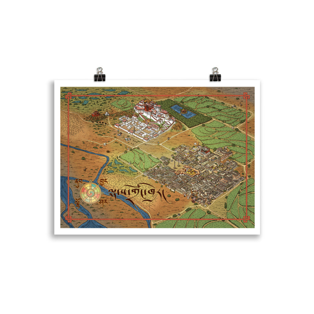
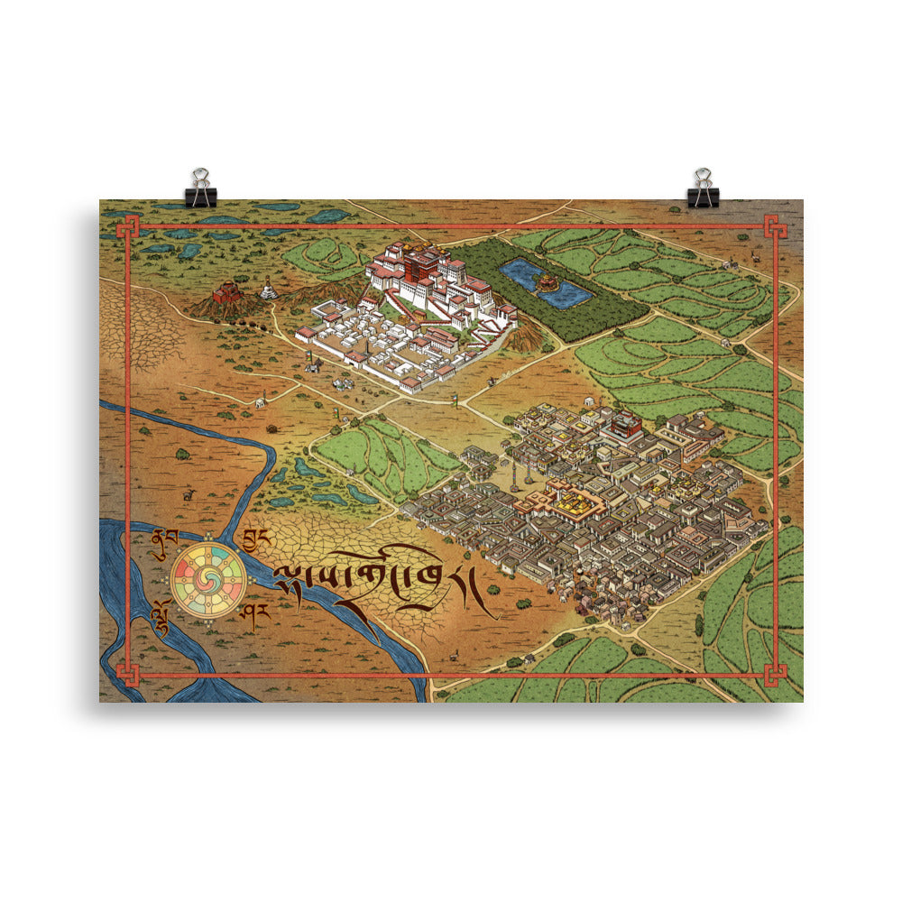
For centuries the city of Lhasa was the seat of the government of the Dalai Lamas and the cultural capital of Central Tibet. Our hand drawn map of Lhasa shows the city as it existed in the late 1930s (with small details changed to accommodate the style). The map is based on photographs taken by Ernst Shaefer in 1938, as well as on other pre-1949 photographs of the Lhasa region. The map features the Potala Palace, as well as the neighboring residential and monastic Barkhor District, all lovingly illustrated with an eye for historical detail.
• Paper thickness: 0.26 mm (10.3 mil)
• Paper weight: 189 g/m²
• Opacity: 94%
• ISO brightness: 104%
• Paper sourced from Japan
This product is made especially for you as soon as you place an order, which is why it takes us a bit longer to deliver it to you. Making products on demand instead of in bulk helps reduce overproduction, so thank you for making thoughtful purchasing decisions!
Share